
Early iOs and Android icons were one of the last offshoot of the style called “Frutiger Aero”
Flat icons don’t necessarily bad and undetailed, it’s just harder to create something more recogniseable with less tools, but I actually like the order, that they look like they are related to each other. Back in the day I created icon packs for the programs I used on pc, so my desktop would look clean and uniform.
Design styles are in a cycle, just wait some years and they will show up again, I’m sure. There is already some connection with the new style of windows 11.


.jpg)
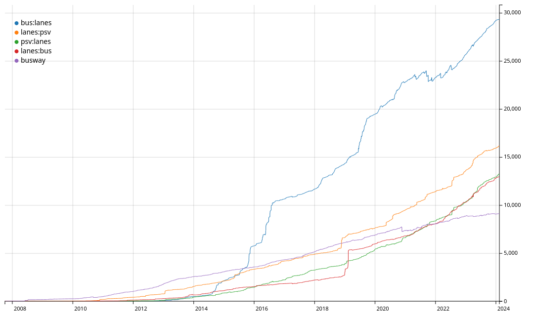
Some more details on the update frequency of services and maps I use:
I wrote this from memory, so it may be not 100% up to date, please correct me if I’m wrong